routed off I-35 onto Highway 30 and 69 and through Ames on South Duff, Lincolnway, and Grand Ave. One could drive around the barrier at Highway 30 and I-35 and continue up to the E-29 exit. There are two interchanges during this 6 « miles; one at E-29 (exit 116) known as the Hartland Road and the other at the south border of Milford Twp at 220th Street (Thirteenth Street, exit 113). There is a reststop for the southbound I35 traffic within Milford Twp just north of 170 Ave.
For years, one of the map makers erroneously had an interchange at the Pleasant Grove Church area. This would be straight east of Gilbert.
For a time during the summer of 1929, when the east-west road (The Lincoln Highway) through Nevada was paved as a part of the Lincoln Highway project, the traffic on that road (officially designate d Primary Road No 30) was routed north 4 miles at State Center then west 20 miles on the county gravel, across Milford Twp to Dayton Park and then south to the standard location of the Lincoln Highway just to the east of Ames. This temporary relocation caused a large number of accidents at the intersection of the Roland Road and the Hartland Road (E29 & S14). There had been 8 reported collisions in two weeks of June 1929.
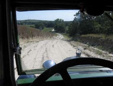
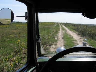
The section of the road from Nevada to Ames was done by two crews- both starting at the North Grant School and one working to the west and the other to the east toward Nevada. This, also, was the time that the road was rerouted straight west in West Ames. Instead of turning north from Lincolnway at the football stadium, onto Sheldon Street, the highway continued to the west. (The football stadium was at the very southwest corner of the campus at that time.) Above and Below: Ungraveled country roads through the windshield of a Model "A" Ford. Pretty to travel but when they're wet, it's a different story.
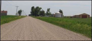
Below: A southbound view of the fine gravel road between Sec 8 and 9 with the Loyd Hughes farmstead in view with the Dave Stensland farmstead at the corner about 5/8 mile away. Sowers lived here at the pictured farmstead, as did George Roberts and Jeffrey Jacobson. For a while in the late sixties, Loyd had a runway and hangar on the east side of this road. Until the sixties there was a good sized barn on the east side of the road, but it was torn down and some of the lumber was used to build a house across the road from Honderds and up on top of the hill. This house burned down a few years later.